Greve Municipality (Greve Kommune)
The site of its municipal council is the town of Greve Strand.
It serves primarily as a residential municipality, functioning as a suburb for the larger Copenhagen area.
Until the 1960s the area was primarily agricultural, and most businesses in town were concentrated along the coastal road "Strandvejen". With numerous holiday cottages near the coast of Køge Bugt (Køge Bay), this was also the destination for many inhabitants of Copenhagen on holiday away from the hustle and bustle of the city.
During the late 1960s and into the 1970s, many people moved permanently out of Copenhagen and into new homes in places like Greve. What was formerly farmers' fields quickly turned into districts of detached houses, whilst most of the shops and similar businesses near the coastal road moved into central shopping malls such as Hundige Storcenter and Greve Midtby Center. Around 1980 the S-train railroad network was expanded towards Køge, and the stations Greve and Hundige were placed adjacent to the shopping malls.
Greve Municipality was formed in 1970, as part of the kommunalreform ("Municipal Reform") of that year. It was established by combining the following parishes:
* Greve
* Hundige
* Karlslunde
* Karlslunde Strand
Map - Greve Municipality (Greve Kommune)
Map


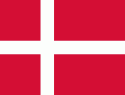
Country - Denmark
 |
 |
| Flag of Denmark | |
As of 2013, the Kingdom of Denmark, including the Faroe Islands and Greenland, has a total of 1,419 islands above 100 m2; 443 of which have been named and of which 78 are inhabited. Spanning a total area of 42943 km2, metropolitan Denmark consists of the northern part of the Jutland peninsula and an archipelago of 406 islands. Of these, the most populated island is Zealand, on which the capital Copenhagen is situated, followed by Funen, the North Jutlandic Island, and Amager. Denmark's geography is characterised by flat, arable land, sandy coasts, low elevation, and a temperate climate. As of 2022, it had a population of 5.928 million (1 October 2022), of which 800,000 live in the capital and largest city, Copenhagen. Denmark exercises hegemonic influence in the Danish Realm, devolving powers to handle internal affairs. Home rule was established in the Faroe Islands in 1948 and in Greenland in 1979; the latter obtained further autonomy in 2009.
Currency / Language
| ISO | Currency | Symbol | Significant figures |
|---|---|---|---|
| DKK | Danish krone | kr | 2 |
| ISO | Language |
|---|---|
| DA | Danish language |
| EN | English language |
| FO | Faroese language |
| DE | German language |